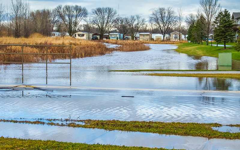
Floodplains
The Federal Emergency Management Agency (FEMA) defines a floodplain as any land area susceptible to being inundated by flood waters from any source. High-risk areas are generally flat areas of land next to a river or stream prone to flooding.
Flood maps, known officially as Flood Insurance Rate Maps (FIRMs), show areas of high, moderate and low-flood risk. Official FIRMs are available through the FEMA Flood Map Service Center.
 |
Effects of Development in the FloodplainDevelopment affects flooding in many ways. Removing vegetation and soil, grading the land, and installing storm sewers increase runoff to streams. The velocity and volume of runoff increases, which results in flooding and erosion downstream. Floodplain and stormwater management regulations reduce these impacts and protect people and property from flooding. Learn more about human impacts on flooding: |
Substantial Improvement / Damage
Substantial improvement is any reconstruction, rehabilitation, addition or other improvement to a building, the total cost of which equals or exceeds 50 percent of the market value of the structure before the start of construction of the improvement. Most ordinances calculate improvements cumulatively; check your local ordinance your specific requirements.
Substantial damage means damage of any origin sustained by a structure whereby the cost of restoring the structure to its before damaged condition would equal or exceed 50 percent of the market value of the structure before the damage occurred.
More information on substantial improvements and substantial damage can be found in the FEMA Substantial Damage Estimator (SDE) Tool.
Flood Insurance
Homes and businesses in high-risk flood areas with mortgages from federally regulated or insured lenders are required to have flood insurance. All renters, homeowners, and business owners with property in a NFIP-participating community, can purchase a policy and are encouraged to consider flood insurance.
Find additional resources and information on the FEMA website:
Community Rating SystemThe Community Rating System (CRS) provides national recognition for communities with programs exceeding the minimum NFIP requirements and reduces flood insurance premiums paid by the residents in that community. Learn more about the Community Rating System: |
How to revise floodplain maps
FEMA Flood Insurance Rate Maps (FIRMs) are based on the best information available at the time of the Flood Insurance Study (FIS). As better information becomes available or as changes are proposed in the floodplain, the floodplain maps should be updated.
- A Letter of Map Amendment (LOMA) can be requested to show that a building or parcel is above the Base Flood Elevation (BFE) and inadvertently included in the Special Flood Hazard Area (SFHA).
- A Letter of Map Revision (LOMR) modifies the effective Flood Insurance Rate Map (FIRM) based on physical changes to a property or a new study that changes the limits of the floodplain.
Learn more about Revising and Maintaining NFIP Maps:
IAFSM Floodplain Management Desk Reference Section 7
What is an Elevation Certificate?
An Elevation Certificate (EC) is an administrative tool used by the National Flood Insurance Program (NFIP). It is used to show compliance with floodplain management ordinances; determine flood insurance premiums; and support a request for a Letter of Map Amendment (LOMA) to remove a building from the Special Flood Hazard Area.